
Hiking is probably the best way to see Niseko’s rich natural environment and scenery. The pace of walking allows you to see plants, insects, animals, clouds and many other unique views you may not have noticed from a car, bike, train etc. Area hiking trails provide access to some of Niseko’s mountains and forests that can’t be accessed otherwise.
Shinsen Numa
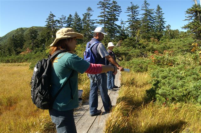
Shinsen Numa is one of the highlights of the Niseko Shakotan Otaru Kaigan Quasi National Park. This alpine wetlands area has a pristine and delicate environment dotted with ponds and wildflowers. The area which is buried under meters of snow for half the year comes to life in the spring to reveal as succession of emerging foliage, wild flower displays, and autumn colors before the seasonal snows fly and it returns to its winter slumber.
Boardwalks extending from the visitors center over the wetlands and around the ponds make for easy access. Shinsen Numa is more of a leisurely stroll than a hike and definitely the most relaxed hike on our list.

Mt. Yotei
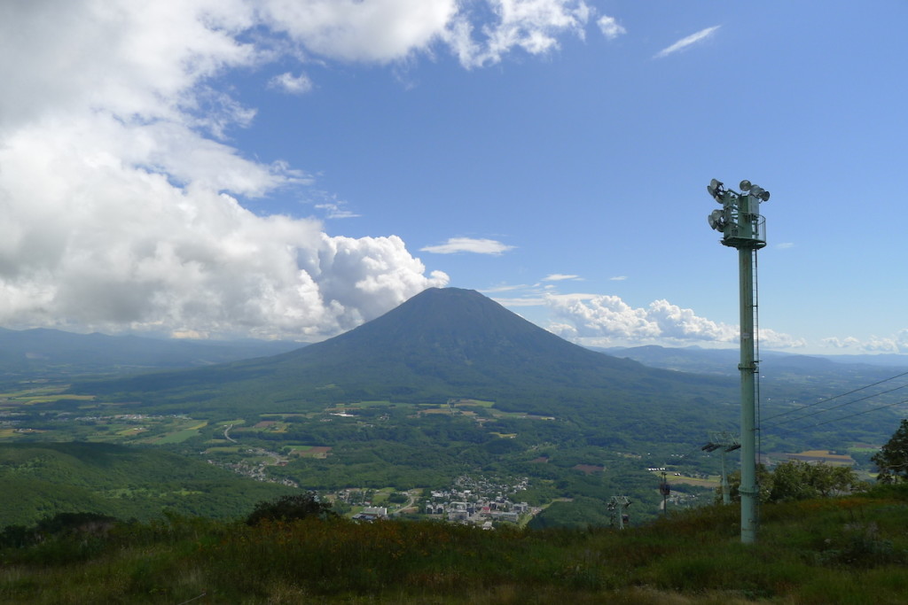
Climbing Mt. Yotei gives you a perspective on the region you don’t get anywhere else. On a clear day you can see the Sea of Japan and the Niseko Range to the west, and Lake Toya and Funka Bay to the southeast. Hiking around Yotei’s summit crater you get a 360 degree view of the greater Shiribeshi area and beyond, with farmland, mountains and other landscape features stretching out as far as the eye can see.
Four climbing routes provide access to Mt. Yotei’s summit from different sides of the mountain.
- Kutchan Route
- Makkari Route
- Kyogoku Route
- Kimobetsu Route
The Kutchan and Makkari Routes are the more widely known routes and generally a bit more easy climbing than the more rugged Kyogoku and Kimobetsu routes.
Niseko Town Area Explore Footpath
Footpath Network Hokkaido is a collection of local organizations that work to establish paths for walking. Paths often use existing roads and paths to establish courses that extend several kilometers and allow the user hours of continuous walking.
Currently two footpaths which interconnect roads and trails have been established in the Niseko area. Maps of and information about the footpaths can be found on the ‘Niseko Rakuza’ website: www13.plala.or.jp/nisekorakuza
Kobo Course / Haru No Taki Course, Hirafu Forest
At the edge of Hirafu is the trailhead for a wonderful loop trail that traverses across the Haru No Taki gully. The trail connects to the parking lot at the Hilton Hotel at Niseko Village, from where you can stroll over to the new Village area for lunch. The trail is accessible as soon as the snow melts off, however the upper ‘Haru No Taki’ section can take longer to melt off some seasons since it lies in Haru No Taki’s notorious avalanche path.
The lower trail called Kobo Course is generally well maintained and free from obstacles. There are bridges and stairs in a few location, as well as wide boardwalks that span some of the wetter sections.
The upper trail called Haru No Taki Course climbs higher up the slopes of Haru No Taki gully and offers some overlooking views from between the trees. Thick sections of native forest sport robust ferns and other impressive vegetation. In the middle of the gully there is a babbling brook that reaches its most vigorous flow during spring snow melts.